Clusters are built purely with an algorithm. In many cases clustering markers depending on a given geographical entity is better (country, administrative region, zipcode, city, whatever).
People are familiar with such entities, and it avoids putting clusters in locations that don’t feel ‘natural’.
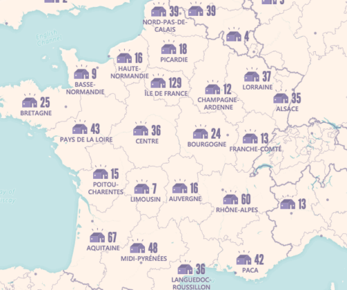
We developed a map where both algorithmical and ‘geographical’ approaches are used (depending on the zoom level) : https://thefoodassembly.com/
So we are both using Leaflet.markercluster and our own cluster logic. They are totally separated, which is a disadvantage because our own clusters don’t benefit from Leaflet.markercluster animations, automatically created clickable polygons, and so on.