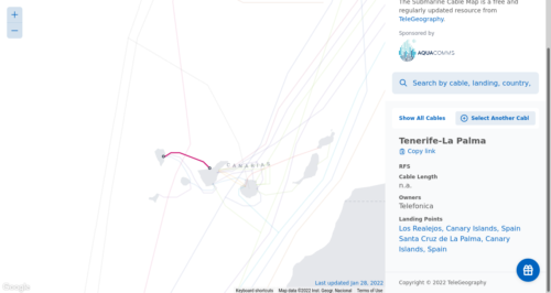
Submarine Cable Map

The Submarine Cable Map is a free and regularly updated resource from TeleGeography.


The Submarine Cable Map is a free and regularly updated resource from TeleGeography.

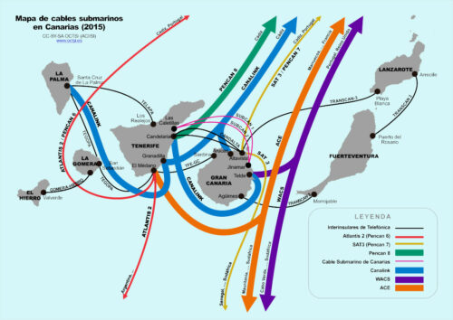
Los cables submarinos en Canarias que conectan las islas entre sí son los siguientes. Entre paréntesis se indica el año de puesta en servicio:
Además, las islas están conectadas con el exterior por los siguientes sistemas:
the telecom operator locates the damaged area by zeroing in on the problematic part. To do this, they send signal pulses through the cable from one end or base station. The damaged area (break) will bounce back the pulse to the signalling site which sent the data. Calculating the time delay from the reflected signal, engineers can zero in on the exact point and area of the problem. Then they send out a large cable repair ship, with fresh optic cables to replace the defective part under the sea. The cable is then lifted from the sea bed using special hooks (grapnel) and dragged onto the ship. The faulty cables are then spliced onboard, joined with a fresh cable, sealed with a watertight and anticorrosive covering and returned back to the seabed. Then the ship sends out the information to the base stations to test the cable again. Once the test signals are reaching the destination, the work is confirmed and the cable is repaired successfully. The data is then switched on and the connection restored. The entire process can take up to 16 hours or more, depending the number of cable breaks, successful repairs, time of day, weather conditions at sea and ships around the area.
Climate disaster could take away both their connection and a crucial source of income. And, ironically enough, these cables are used to help gather data on climate impacts, so climate change could mess up the very tools we need to monitor the impact of climate change.