
The true size of Africa

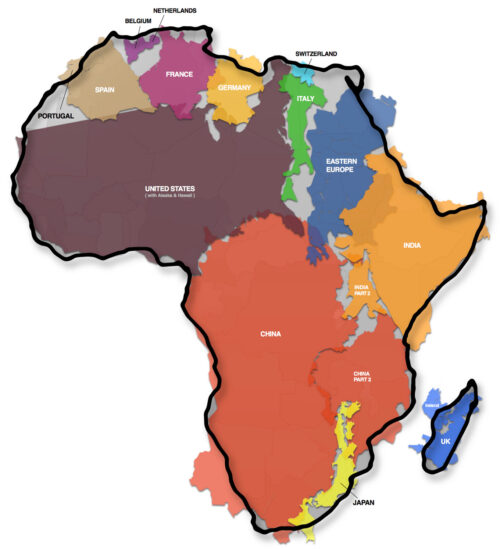
The whole point being made was that we all have been taught geography mainly based on the Mercator projection – as the background in daily television news, the cover of my school atlas, in general the ubiquitous depiction of the planet.
But the basic fact is that a three-dimensional sphere being shown as a single two-dimensional flat image will always be subject to a conversion loss: something has to give…
The reason why Mercator was such an important advance is simple: on it one can draw straight lines to account for travel routes – in the days of the gigantic merchant fleets and naval battles an immensely valuable attribute.